Good morning, everyone! Please take a moment to give this a read…Based on the latest guidance from the SPC's SSEO…
Posted by Nick Lilja WDAM on Thursday, March 10, 2016
The Models
SSEO:

HRRR:

Good morning, everyone! Please take a moment to give this a read…Based on the latest guidance from the SPC's SSEO…
Posted by Nick Lilja WDAM on Thursday, March 10, 2016
SSEO:

HRRR:


From the SPC… …SUMMARY… SEVERE THUNDERSTORMS CAPABLE OF PRODUCING TORNADOES…DAMAGING WINDS…AND ISOLATED LARGE HAIL WILL BE LIKELY OVER PORTIONS OF THE GULF COAST STATES THROUGH TONIGHT. A FEW STRONG TORNADOES WILL BE POSSIBLE. …SYNOPSIS… AN INTENSE SHORTWAVE TROUGH AND ASSOCIATED MID-UPPER JET STREAK WILL PROGRESS EWD OVER THE GULF COAST STATES THROUGH TONIGHT. STRONG ASCENT IN THE LEFT EXIT REGION… Read more →

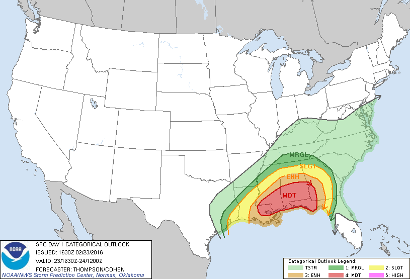
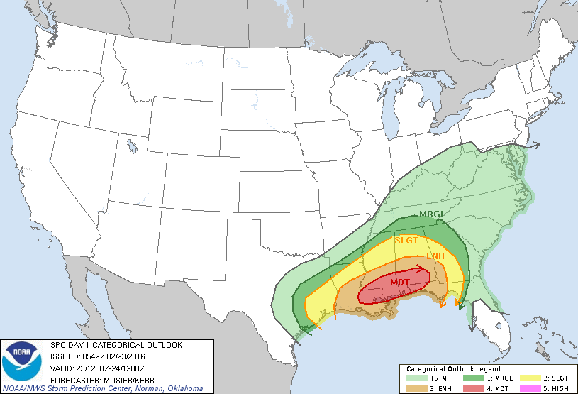
From the Storm Prediction Center: SUMMARY… SEVERE THUNDERSTORMS CAPABLE OF DAMAGING WINDS AND TORNADOES WILL BE LIKELY OVER PORTIONS OF THE GULF COAST STATES TUESDAY. A FEW OF THE TORNADOES MAY BE STRONG…ESPECIALLY TUESDAY AFTERNOON AND INTO TUESDAY NIGHT. SYNOPSIS… STRONG SHORTWAVE TROUGH WILL PROGRESS ACROSS THE SRN PLAINS AND LWR MS VALLEY DURING THE PERIOD WHILE RAPIDLY DEEPENING. THE… Read more →

EDITOR’S NOTE: The SPC upgraded sections of the south to a Moderate Risk. Details here! Good morning, everyone. Just a quick update after the overnight and early morning data was processed. The Numbers It looks like there is still a very real threat for severe weather. Here is a look at the Severe Weather Worksheet. The “Big 4 AVG” is… Read more →

EDITOR’S NOTE: The SPC upgraded sections of the south to a Moderate Risk. Details here! (Editor’s Note: I’m currently battling a fever and did this while taking cold medicine, please be understanding of typos) As a deepening area of low pressure develops across parts of eastern Texas and moves across Arkansas, Mississippi, Alabama, and eventually into Georgia, the threat… Read more →