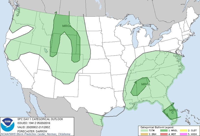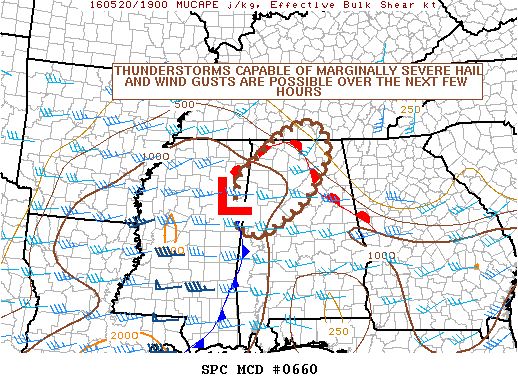
NOAA Storm Prediction Center Mesoscale Discussion 661
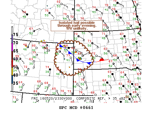
MD 0661 CONCERNING SEVERE POTENTIAL…WATCH UNLIKELY FOR NERN WY…SWRN SD…FAR NWRN NEB…FAR SERN MT MESOSCALE DISCUSSION 0661 NWS STORM PREDICTION CENTER NORMAN OK 0648 PM CDT FRI MAY 20 2016 AREAS AFFECTED…NERN WY…SWRN SD…FAR NWRN NEB…FAR SERN MT CONCERNING…SEVERE POTENTIAL…WATCH UNLIKELY VALID 202348Z – 210115Z PROBABILITY OF WATCH ISSUANCE…5 PERCENT SUMMARY…AN ISOLATED HAIL THREAT WILL EXIST FOR THE NEXT 1-2… Read more →