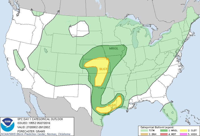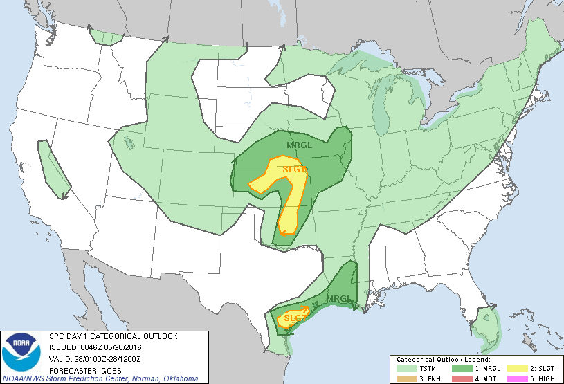
Storm Prediction Center May 28, 2016 UTC Evening Outlook
SPC 0100Z Day 1 Outlook DAY 1 CONVECTIVE OUTLOOK NWS STORM PREDICTION CENTER NORMAN OK 0746 PM CDT FRI MAY 27 2016 VALID 280100Z – 281200Z …THERE IS A SLGT RISK OF SEVERE THUNDERSTORMS ACROSS PORTIONS OF SERN NEB AND SWD ACROSS KS/CENTRAL OK… …THERE IS A SLGT RISK OF SEVERE THUNDERSTORMS ACROSS PORTIONS OF THE MIDDLE TX COASTAL AREA…… Read more →