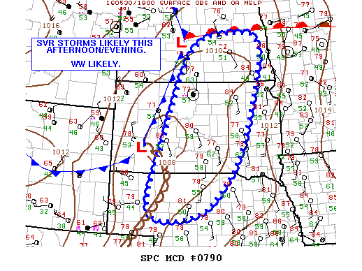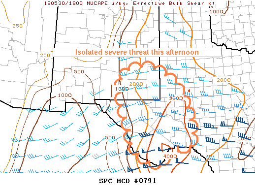
NOAA Storm Prediction Center Mesoscale Discussion 791
MD 0791 CONCERNING SEVERE POTENTIAL…WATCH UNLIKELY FOR SOUTHWESTERN TEXAS AND SOUTHEASTERN NEW MEXICO MESOSCALE DISCUSSION 0791 NWS STORM PREDICTION CENTER NORMAN OK 0228 PM CDT MON MAY 30 2016 AREAS AFFECTED…SOUTHWESTERN TEXAS AND SOUTHEASTERN NEW MEXICO CONCERNING…SEVERE POTENTIAL…WATCH UNLIKELY VALID 301928Z – 302130Z PROBABILITY OF WATCH ISSUANCE…20 PERCENT SUMMARY…THUNDERSTORMS CONTINUE TO INCREASE IN COVERAGE ACROSS THE HIGHER TERRAIN OF SOUTHWEST… Read more →