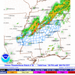

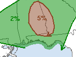
NWS watching Alabama, Georgia severe weather potential
The national weather service is currently looking at the southern half of Alabama and parts of western Georgia for severe weather development this afternoon. The current atmospheric set up is conducive to severe weather development through the afternoon. Both the CAPE and Shear values will support a few isolated supercell thunderstorms with the potential for large hail and an isolated tornado. Right now the… Read more →
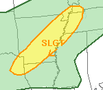
Texas, Arkansas face severe threat Sunday night
Earlier today it looked like Parts of Texas, Arkansas, Missouri, Tennessee and Kentucky would be battling isolated severe thunderstorms. Recently, the higher resolution computer weather models have leaned toward a far more isolated event. Current conditions show that colder air continues to erode away in the lower levels of the atmosphere. This will inhibit the production of severe storms in… Read more →
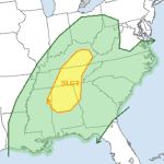
Severe thunderstorms threaten Kentucky, Tennessee, Alabama Monday
It looks like another round of severe thunderstorms are headed toward the souther Ohio River Valley, parts of Kentucky, Tennessee and Alabama. Scenario As a cold front associated with an area of low pressure swings through the Ohio, Tennessee, Kentucky area the threat for severe weather is possible. The bulk of the severe weather potential will be from Lexington, Kentucky… Read more →
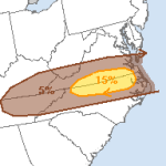
Mid-Atlantic thunderstorm chances tomorrow
The zonal / west-northwest flow pattern that’s set up across much of the US will spark an opportunity for showers and thunderstorms – some severe – on Saturday for southern Virginia and northern North Carolina. Cities like Raleigh and Greensboro, NC and Roanoke, VA should keep an eye to the sky tomorrow. The catalyst for the thunderstorm chances are a few disturbances… Read more →

