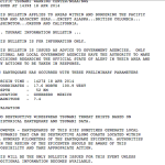
M 7.5 – 75km SW of Panguna, Papua New Guinea
ShakeMap – VII DYFI? – I Time 2014-04-19 13:27:59 UTC 2014-04-19 23:27:59 +10:00 at epicenter Location 6.720°S 154.932°E Depth 30.87 km (19.18 mi) Powered by WPeMatico
ShakeMap – VII DYFI? – I Time 2014-04-19 13:27:59 UTC 2014-04-19 23:27:59 +10:00 at epicenter Location 6.720°S 154.932°E Depth 30.87 km (19.18 mi) Powered by WPeMatico
Time 2014-04-19 13:28:00 UTC 2014-04-19 23:28:00 +10:00 at epicenter Location 6.700°S 155.000°E Depth 10.00 km (6.21 mi) Powered by WPeMatico
Time 2014-04-19 01:04:06 UTC 2014-04-19 11:04:06 +10:00 at epicenter Location 6.701°S 155.069°E Depth 45.46 km (28.25 mi) Powered by WPeMatico

DYFI? – VI Time 2014-04-18 14:27:29 UTC 2014-04-18 07:27:29 -07:00 at epicenter Location 17.585°N 100.741°W Depth 48.61 km (30.20 mi) Powered by WPeMatico
ShakeMap – I DYFI? – I Time 2014-04-15 03:57:02 UTC 2014-04-15 04:57:02 +01:00 at epicenter Location 53.527°S 8.704°E Depth 11.74 km (7.29 mi) Powered by WPeMatico