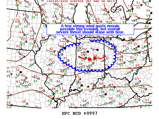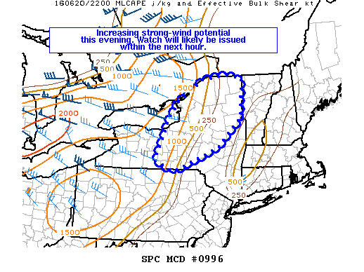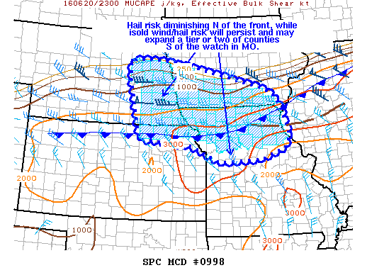
NOAA Storm Prediction Center Mesoscale Discussion 998
MD 0998 CONCERNING SEVERE THUNDERSTORM WATCH 276… FOR ERN NEB…SRN IA…NRN MO…NE KS MESOSCALE DISCUSSION 0998 NWS STORM PREDICTION CENTER NORMAN OK 0642 PM CDT MON JUN 20 2016 AREAS AFFECTED…ERN NEB…SRN IA…NRN MO…NE KS CONCERNING…SEVERE THUNDERSTORM WATCH 276… VALID 202342Z – 210045Z THE SEVERE WEATHER THREAT FOR SEVERE THUNDERSTORM WATCH 276 CONTINUES. SUMMARY…THREAT FOR ISOLATED DAMAGING WINDS AND LARGE… Read more →