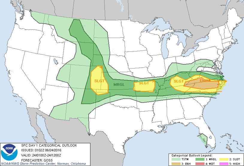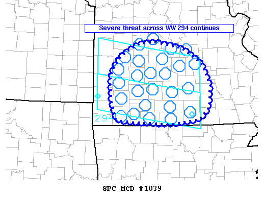
NOAA Storm Prediction Center Mesoscale Discussion 1039
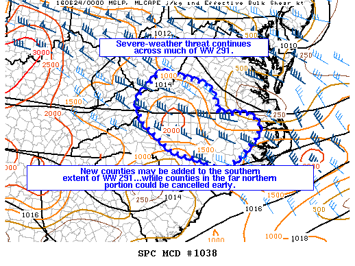
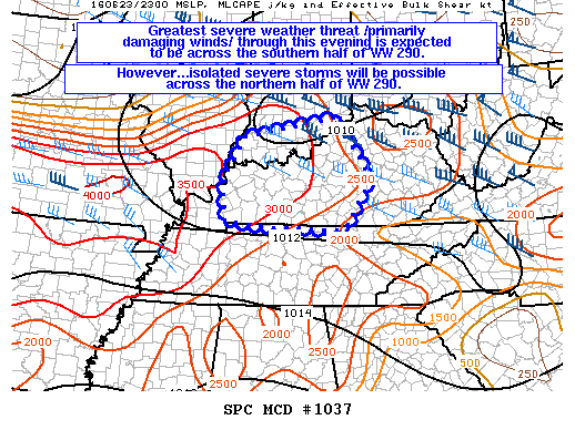
MD 1039 CONCERNING SEVERE THUNDERSTORM WATCH 292…294… FOR SOUTHERN MISSOURI MESOSCALE DISCUSSION 1039 NWS STORM PREDICTION CENTER NORMAN OK 0911 PM CDT THU JUN 23 2016 AREAS AFFECTED…SOUTHERN MISSOURI CONCERNING…SEVERE THUNDERSTORM WATCH 292…294… VALID 240211Z – 240415Z THE SEVERE WEATHER THREAT FOR SEVERE THUNDERSTORM WATCH 292…294…CONTINUES. SUMMARY…THE SEVERE THREAT CONTINUES ACROSS CENTRAL AND EASTERN PORTIONS OF WW 294…AND HAS EXITED… Read more →