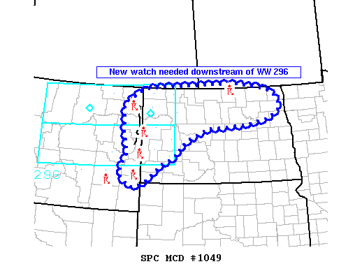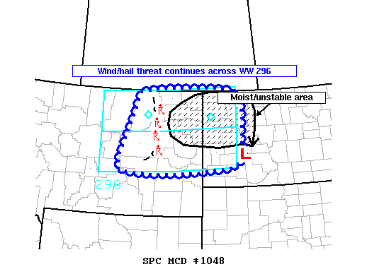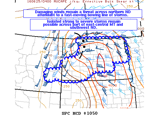
NOAA Storm Prediction Center Mesoscale Discussion 1050
MD 1050 CONCERNING SEVERE THUNDERSTORM WATCH 296…297… FOR WESTERN AND CENTRAL ND AND PART OF EASTERN MT MESOSCALE DISCUSSION 1050 NWS STORM PREDICTION CENTER NORMAN OK 1204 AM CDT SAT JUN 25 2016 AREAS AFFECTED…WESTERN AND CENTRAL ND AND PART OF EASTERN MT CONCERNING…SEVERE THUNDERSTORM WATCH 296…297… VALID 250504Z – 250700Z THE SEVERE WEATHER THREAT FOR SEVERE THUNDERSTORM WATCH 296…297…CONTINUES…. Read more →