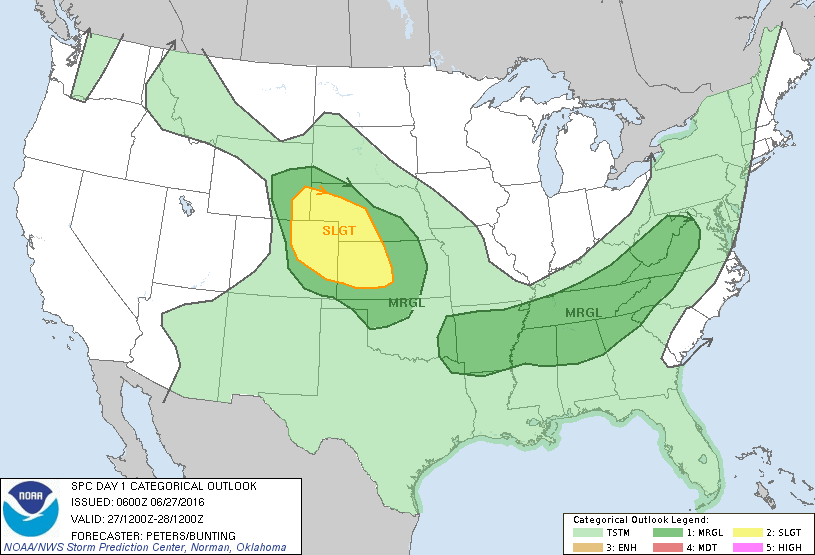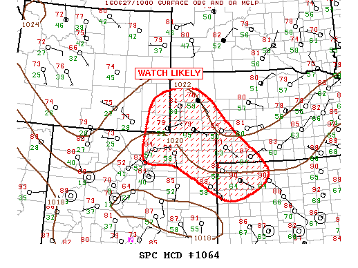
NOAA Storm Prediction Center Mesoscale Discussion 1064
MD 1064 CONCERNING SEVERE POTENTIAL…WATCH LIKELY FOR SERN WY…WRN NEBRASKA…NERN CO…NWRN KS MESOSCALE DISCUSSION 1064 NWS STORM PREDICTION CENTER NORMAN OK 0136 PM CDT MON JUN 27 2016 AREAS AFFECTED…SERN WY…WRN NEBRASKA…NERN CO…NWRN KS CONCERNING…SEVERE POTENTIAL…WATCH LIKELY VALID 271836Z – 271930Z PROBABILITY OF WATCH ISSUANCE…95 PERCENT SUMMARY…THUNDERSTORMS ARE EXPECTED TO DEVELOP AND INCREASE IN AREAL COVERAGE ACROSS THE CENTRAL HIGH… Read more →