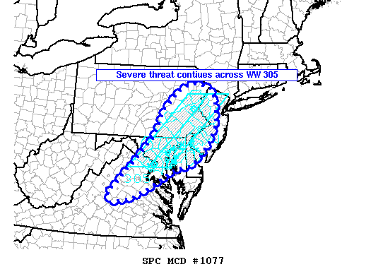
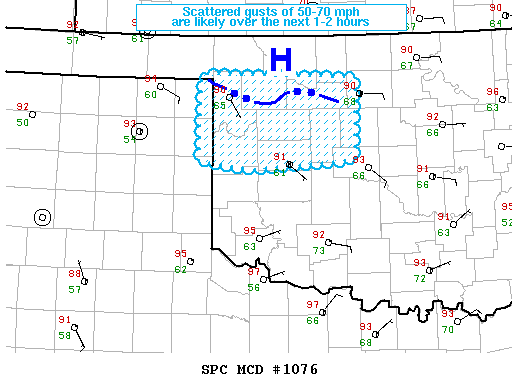
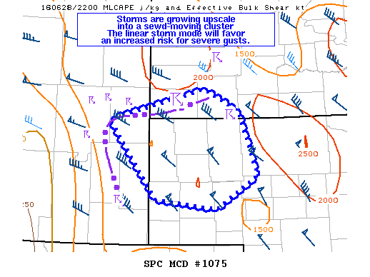
NOAA Storm Prediction Center Mesoscale Discussion 1078
MD 1078 CONCERNING SEVERE THUNDERSTORM WATCH 304… FOR NEB PANHANDLE MESOSCALE DISCUSSION 1078 NWS STORM PREDICTION CENTER NORMAN OK 0636 PM CDT TUE JUN 28 2016 AREAS AFFECTED…NEB PANHANDLE CONCERNING…SEVERE THUNDERSTORM WATCH 304… VALID 282336Z – 290000Z THE SEVERE WEATHER THREAT FOR SEVERE THUNDERSTORM WATCH 304 CONTINUES. SUMMARY…THE TRANSITION TO A HIGH-END THUNDERSTORM WIND GUST EVENT IS NOW UNDERWAY. GUSTS… Read more →