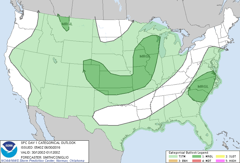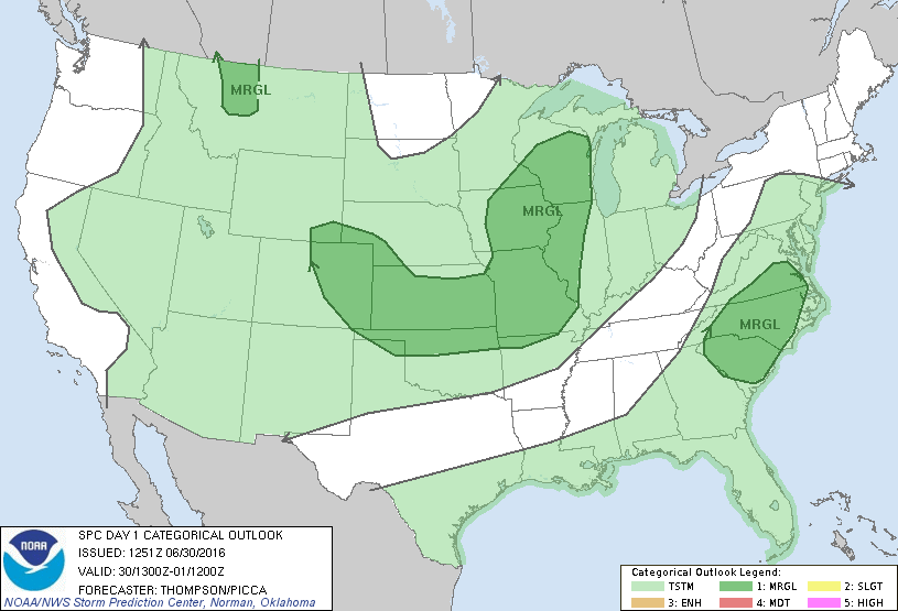
Storm Prediction Center Jun 30, 2016 Morning Outlook
SPC 1300Z Day 1 Outlook DAY 1 CONVECTIVE OUTLOOK NWS STORM PREDICTION CENTER NORMAN OK 0751 AM CDT THU JUN 30 2016 VALID 301300Z – 011200Z …THERE IS A MRGL RISK OF SEVERE THUNDERSTORMS FROM PARTS OF THE MID-UPPER MS VALLEY SWWD TO SE KS…AND WWD TO ERN CO… …THERE IS A MRGL RISK OF SEVERE THUNDERSTORMS THIS AFTERNOON FOR… Read more →