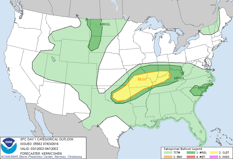
Storm Prediction Center Jul 3, 2016 Early Morning UTC Day 1 Convective Outlook
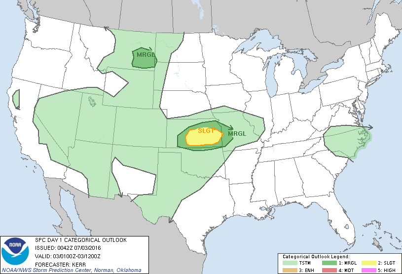
SPC 1200Z Day 1 Outlook DAY 1 CONVECTIVE OUTLOOK NWS STORM PREDICTION CENTER NORMAN OK 1258 AM CDT SUN JUL 03 2016 VALID 031200Z – 041200Z …THERE IS A SLGT RISK OF SEVERE THUNDERSTORMS TODAY INTO TONIGHT ACROSS PARTS OF THE MIDDLE MISSISSIPPI INTO LOWER OHIO VALLEYS…AND ACROSS PARTS OF THE SOUTH CENTRAL PLAINS… …THERE IS A MRGL RISK OF… Read more →