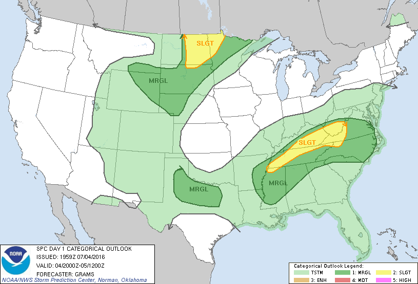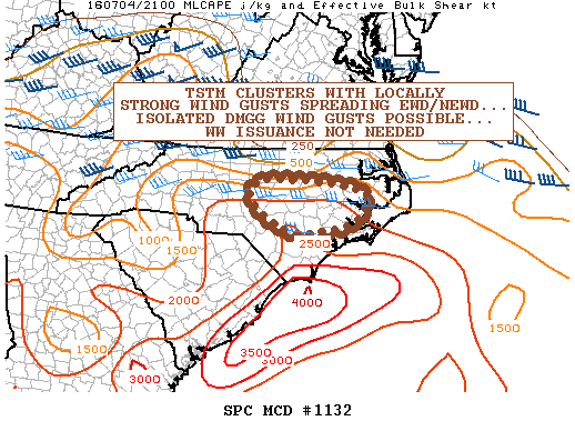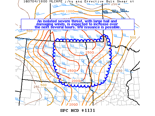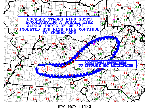
NOAA Storm Prediction Center Mesoscale Discussion 1133
MD 1133 CONCERNING SEVERE THUNDERSTORM WATCH 321… FOR PORTIONS OF KY/TN/WV/VA/NC MESOSCALE DISCUSSION 1133 NWS STORM PREDICTION CENTER NORMAN OK 0450 PM CDT MON JUL 04 2016 AREAS AFFECTED…PORTIONS OF KY/TN/WV/VA/NC CONCERNING…SEVERE THUNDERSTORM WATCH 321… VALID 042150Z – 042345Z THE SEVERE WEATHER THREAT FOR SEVERE THUNDERSTORM WATCH 321 CONTINUES. SUMMARY…LOCALLY STRONG WIND GUSTS WILL CONTINUE TO ACCOMPANY A SQUALL LINE… Read more →