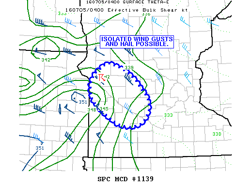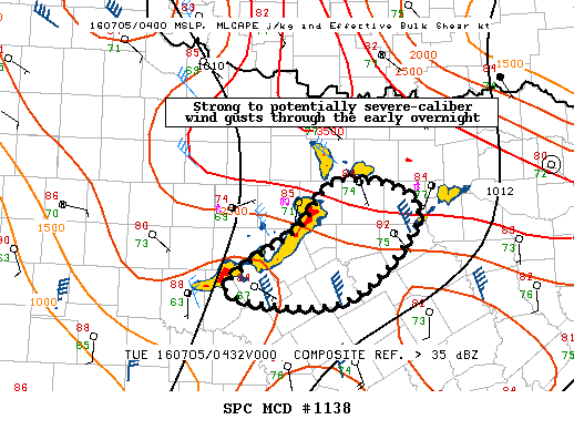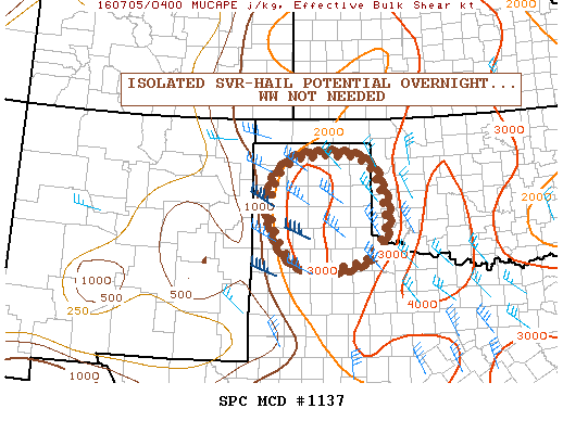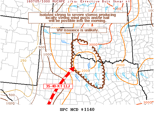
NOAA Storm Prediction Center Mesoscale Discussion 1140
MD 1140 CONCERNING SEVERE POTENTIAL…WATCH UNLIKELY FOR SOUTHWEST OK AND PARTS OF NORTHWEST TO NORTH-CENTRAL TX MESOSCALE DISCUSSION 1140 NWS STORM PREDICTION CENTER NORMAN OK 0519 AM CDT TUE JUL 05 2016 AREAS AFFECTED…SOUTHWEST OK AND PARTS OF NORTHWEST TO NORTH-CENTRAL TX CONCERNING…SEVERE POTENTIAL…WATCH UNLIKELY VALID 051019Z – 051245Z PROBABILITY OF WATCH ISSUANCE…5 PERCENT SUMMARY…THUNDERSTORMS INCREASING IN COVERAGE EARLY THIS… Read more →