7/10/19 9PM Facebook Live Tropical Chat
Just in case you missed my facebook live tropical discussion tonight, here it is! This may save you from having to wee through facebook in order to find it!
Just in case you missed my facebook live tropical discussion tonight, here it is! This may save you from having to wee through facebook in order to find it!

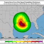
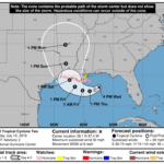
Fromt eh NHC BULLETIN Potential Tropical Cyclone Two Advisory Number 3 NWS National Hurricane Center Miami FL AL022019 1000 PM CDT Wed Jul 10 2019 …SYSTEM IS ALMOST A TROPICAL DEPRESSION… …STORM SURGE, HEAVY RAINS, AND HURRICANE CONDITIONS ARE POSSIBLE ACROSS THE NORTH-CENTRAL GULF COAST IN A COUPLE OF DAYS… SUMMARY OF 1000 PM CDT…0300 UTC…INFORMATION ———————————————– LOCATION…27.7N 88.0W ABOUT… Read more →

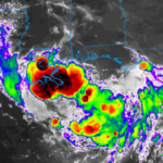
Potential Tropical Cyclone Two Discussion Number 2 NWS National Hurricane Center Miami FL AL022019 400 PM CDT Wed Jul 10 2019 Data from An Air Force Reserve reconnaissance aircraft, surface observations, and satellite imagery indicate that the broad low pressure system located over the northeastern Gulf of Mexico still lacks a well-defined circulation center. Multiple low-level swirls associated with individual… Read more →

10:00AM UPDATE: The National Hurricane Center is now referring to Invest 92L as Potential Tropical Cyclone Two. ORIGINAL: The National Hurricane Center continues to monitor Invest 92L. Development into a Tropical Depression is considered, nearly, imminent. The NHC has also scheduled a trip out to the Invest by the Hurricane Hunters. If this system develops into a Tropical Storm it… Read more →

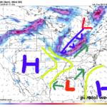
As Invest 92L drifts south toward the Gulf of Mexico, the models are starting to show their cards in terms of why things will eventually look like they are going to look, and why – as forecasters – it is very difficult to nail down specifics. Up at 10,000 feet A game of tug-og-war is being played up at 10,000… Read more →