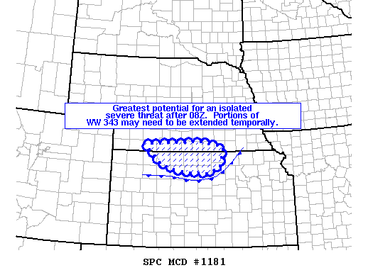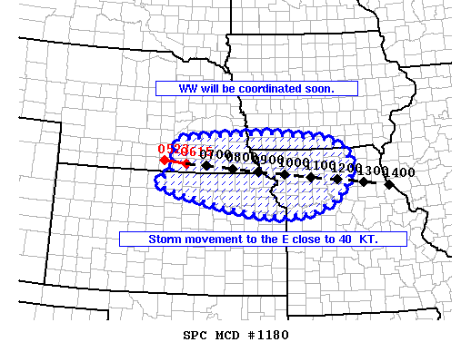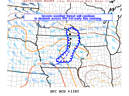
NOAA Storm Prediction Center Mesoscale Discussion 1182
MD 1182 CONCERNING SEVERE THUNDERSTORM WATCH 344… FOR NORTHERN AND CENTRAL IA TO SOUTHEAST MN MESOSCALE DISCUSSION 1182 NWS STORM PREDICTION CENTER NORMAN OK 0352 AM CDT THU JUL 07 2016 AREAS AFFECTED…NORTHERN AND CENTRAL IA TO SOUTHEAST MN CONCERNING…SEVERE THUNDERSTORM WATCH 344… VALID 070852Z – 071015Z THE SEVERE WEATHER THREAT FOR SEVERE THUNDERSTORM WATCH 344 CONTINUES. SUMMARY…THE SEVERE-WEATHER THREAT… Read more →