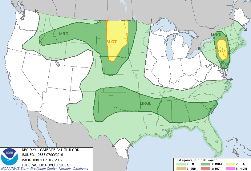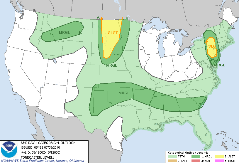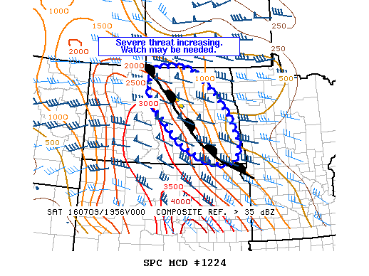
NOAA Storm Prediction Center Mesoscale Discussion 1224
MD 1224 CONCERNING SEVERE POTENTIAL…WATCH POSSIBLE FOR PORTIONS OF CENTRAL AND EASTERN ND MESOSCALE DISCUSSION 1224 NWS STORM PREDICTION CENTER NORMAN OK 0321 PM CDT SAT JUL 09 2016 AREAS AFFECTED…PORTIONS OF CENTRAL AND EASTERN ND CONCERNING…SEVERE POTENTIAL…WATCH POSSIBLE VALID 092021Z – 092145Z PROBABILITY OF WATCH ISSUANCE…40 PERCENT SUMMARY…STRONG TO SEVERE STORMS MAY PRODUCE SOME HAIL AND STRONG WIND GUSTS… Read more →