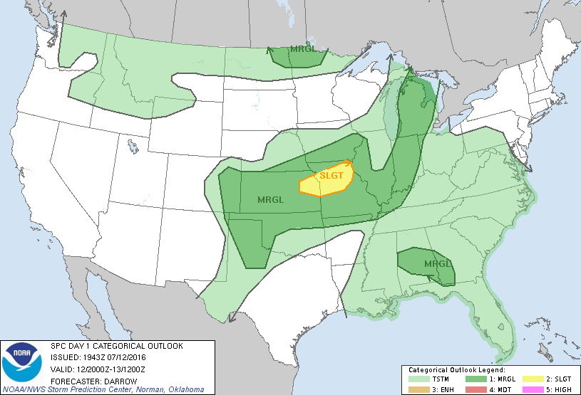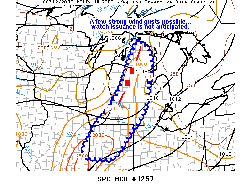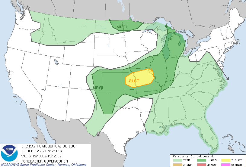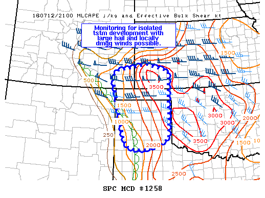
NOAA Storm Prediction Center Mesoscale Discussion 1258
MD 1258 CONCERNING SEVERE POTENTIAL…WATCH POSSIBLE FOR TX PANHANDLE AND NRN TX SOUTH PLAINS…OK PANHANDLE…SWRN KS…FAR SERN CO MESOSCALE DISCUSSION 1258 NWS STORM PREDICTION CENTER NORMAN OK 0511 PM CDT TUE JUL 12 2016 AREAS AFFECTED…TX PANHANDLE AND NRN TX SOUTH PLAINS…OK PANHANDLE…SWRN KS…FAR SERN CO CONCERNING…SEVERE POTENTIAL…WATCH POSSIBLE VALID 122211Z – 122345Z PROBABILITY OF WATCH ISSUANCE…40 PERCENT SUMMARY…ISOLATED THUNDERSTORM… Read more →