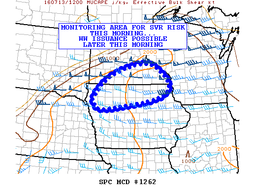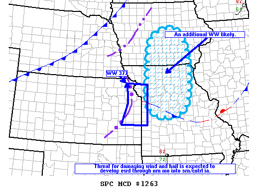
NOAA Storm Prediction Center Mesoscale Discussion 1263
MD 1263 CONCERNING SEVERE THUNDERSTORM WATCH 377… FOR NERN KS THROUGH NRN MO AND SRN/CNTRL IA MESOSCALE DISCUSSION 1263 NWS STORM PREDICTION CENTER NORMAN OK 1033 AM CDT WED JUL 13 2016 AREAS AFFECTED…NERN KS THROUGH NRN MO AND SRN/CNTRL IA CONCERNING…SEVERE THUNDERSTORM WATCH 377… VALID 131533Z – 131730Z THE SEVERE WEATHER THREAT FOR SEVERE THUNDERSTORM WATCH 377 CONTINUES. SUMMARY…THE… Read more →