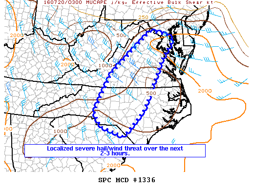
NOAA Storm Prediction Center Mesoscale Discussion 1336
MD 1336 CONCERNING SEVERE POTENTIAL…WATCH UNLIKELY FOR PORTIONS OF NC…VA…DC…AND MD MESOSCALE DISCUSSION 1336 NWS STORM PREDICTION CENTER NORMAN OK 1014 PM CDT TUE JUL 19 2016 AREAS AFFECTED…PORTIONS OF NC…VA…DC…AND MD CONCERNING…SEVERE POTENTIAL…WATCH UNLIKELY VALID 200314Z – 200445Z PROBABILITY OF WATCH ISSUANCE…5 PERCENT SUMMARY…ISOLATED STRONG WIND/HAIL REPORTS WILL REMAIN POSSIBLE THROUGH 05Z OR SO…BUT THE SEVERE THREAT SHOULD WANE… Read more →