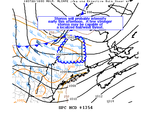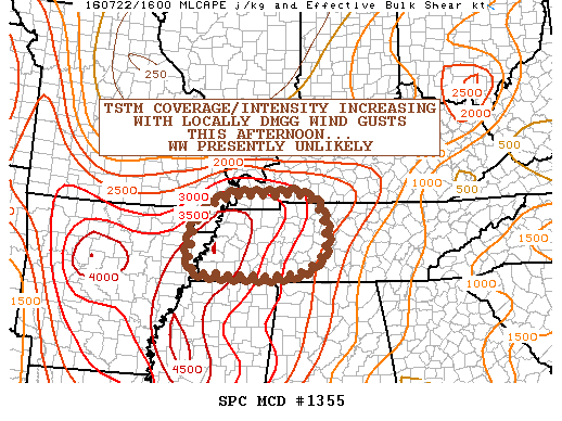
NOAA Storm Prediction Center Mesoscale Discussion 1355
MD 1355 CONCERNING SEVERE POTENTIAL…WATCH UNLIKELY FOR PORTIONS OF SWRN KY…WRN/MIDDLE TN…FAR SERN MO…FAR NERN AR MESOSCALE DISCUSSION 1355 NWS STORM PREDICTION CENTER NORMAN OK 1136 AM CDT FRI JUL 22 2016 AREAS AFFECTED…PORTIONS OF SWRN KY…WRN/MIDDLE TN…FAR SERN MO…FAR NERN AR CONCERNING…SEVERE POTENTIAL…WATCH UNLIKELY VALID 221636Z – 221900Z PROBABILITY OF WATCH ISSUANCE…20 PERCENT SUMMARY…A CLUSTER OF TSTMS WILL SPREAD… Read more →