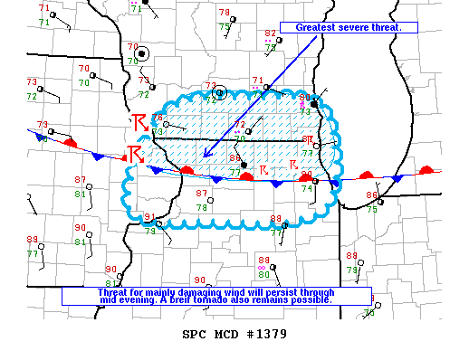
NOAA Storm Prediction Center Mesoscale Discussion 1379
MD 1379 CONCERNING SEVERE THUNDERSTORM WATCH 412… FOR ERN IA…EXTREME SRN WI AND NRN IL MESOSCALE DISCUSSION 1379 NWS STORM PREDICTION CENTER NORMAN OK 0525 PM CDT SAT JUL 23 2016 AREAS AFFECTED…ERN IA…EXTREME SRN WI AND NRN IL CONCERNING…SEVERE THUNDERSTORM WATCH 412… VALID 232225Z – 240030Z THE SEVERE WEATHER THREAT FOR SEVERE THUNDERSTORM WATCH 412 CONTINUES. SUMMARY…THE THREAT FOR… Read more →