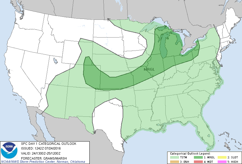
Storm Prediction Center Jul 24, 2016 Morning Outlook
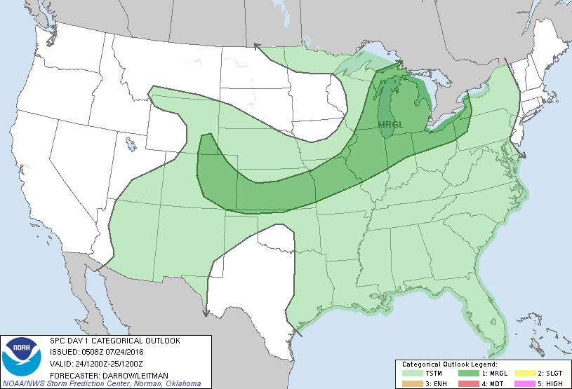
SPC 1300Z Day 1 Outlook DAY 1 CONVECTIVE OUTLOOK NWS STORM PREDICTION CENTER NORMAN OK 0742 AM CDT SUN JUL 24 2016 VALID 241300Z – 251200Z …THERE IS A MRGL RISK OF SEVERE THUNDERSTORMS GREAT LAKES TO CNTRL HIGH PLAINS… …SUMMARY… ISOLATED SEVERE STORMS WILL BE POSSIBLE ACROSS THE GREAT LAKES AND MIDWEST REGIONS…ALONG WITH THE CENTRAL HIGH PLAINS…MAINLY LATE… Read more →