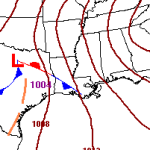
Gulf Coast faces severe weather threat Nov 22-23
Saturday night and into Sunday morning Louisiana, Southern Mississippi and southern Alabama will be dealing with the opportunity for severe weather. Scenario An area of low pressure will swing through Texas and move across the lower Mississippi valley and into southern Tennessee and northern Alabama. As it moves through a warm front will allow moisture to surge northward out of… Read more →

