M 3.6 – 6km ENE of Irving, Texas
ShakeMap – IV DYFI? – V Time 2015-01-07 00:52:09 UTC 2015-01-06 18:52:09 -06:00 at epicenter Location 32.837°N 96.890°W Depth 5.00 km (3.11 mi) Powered by WPeMatico
ShakeMap – IV DYFI? – V Time 2015-01-07 00:52:09 UTC 2015-01-06 18:52:09 -06:00 at epicenter Location 32.837°N 96.890°W Depth 5.00 km (3.11 mi) Powered by WPeMatico
ShakeMap – IV DYFI? – V Time 2015-01-06 21:10:31 UTC 2015-01-06 15:10:31 -06:00 at epicenter Location 32.836°N 96.901°W Depth 5.16 km (3.21 mi) Powered by WPeMatico
If you watch any national news broadcast today or tomorrow, I have a prediction. There is a 100-percent chance of weather bologna. It’s a guarantee. Weather grabs ratings, and ratings matter more than anything. So it seems that the big wigs are telling the little wigs to tell the talking heads to keep fluffing up the weather. Here’s a forecast… Read more →
I received an email from one of the engineers at the television station I work for recently about a way some people react to a thunderstorm that really, really scared me. It was in the second paragraph. Actually, it was the second paragraph. It read: “They turn off their televisions when the weather gets bad.” Apparently, turning your TV off… Read more →
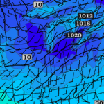
MD 0028 CONCERNING HEAVY SNOW FOR EASTERN IA/NORTH-CENTRAL IL TO CENTRAL INDIANA/SOUTHWEST OH MESOSCALE DISCUSSION 0028 NWS STORM PREDICTION CENTER NORMAN OK 0629 PM CST MON JAN 05 2015 AREAS AFFECTED…EASTERN IA/NORTH-CENTRAL IL TO CENTRAL INDIANA/SOUTHWEST OH CONCERNING…HEAVY SNOW VALID 060029Z – 060530Z SUMMARY…MODERATE TO HEAVY SNOW WILL CONTINUE TO DEVELOP EAST-SOUTHEASTWARD TONIGHT FROM EASTERN IA /INCLUDING I-80 CORRIDOR/ AND… Read more →

