8am Tropical Storm Gordon Update – no hype, no frills, just info
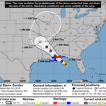
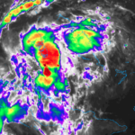
Tropical Storm Gordon continues to move across the Gulf of Mexico and toward the Mississippi coast. The low-level area of circulation is offset from most of the storm activity giving Gordon a one-sided look. Unfortunately for the northern Gulf coast states, most of the rain, wind and surge will be on the northern side of Gordon. Where is this thing… Read more →

Tropical Storm Gordon – 10AM Update with ‘under the hood’ forecast info
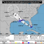
The National Hurricane Center forecast track has shifted Gordon back to the east again. It is still looking to make landfall between Tuesday afternoon and Wednesday morning along he northern Gulf Coast – generally – between New Orleans, Louisiana and Mobile, Alabama. The forecast may continue to wobble here and there during the next 24 hours. But some take-aways are… Read more →

The Potential Tropical Cyclone Seven (Invest 91L / Tropical Storm Gordon) 10PM Update
Here is a current look at Potential Tropical Cyclone Seven: The latest from the National Hurricane Center: SUMMARY OF 1100 PM EDT…0300 UTC…INFORMATION ———————————————– LOCATION…23.4N 78.7W ABOUT 175 MI…285 KM ESE OF MARATHON FLORIDA MAXIMUM SUSTAINED WINDS…30 MPH…45 KM/H PRESENT MOVEMENT…WNW OR 300 DEGREES AT 15 MPH…24 KM/H MINIMUM CENTRAL PRESSURE…1012 MB…29.89 INCHES As per standard operating procedures, here is… Read more →
A quick breakdown of info on Invest 91L
Here is a quick breakdown regarding Invest 91L… WHAT: The National Hurricane Center has increased the chance of tropical development to 70% during the next two days (for more info on what “tropical development” means, check this out: http://nickelblock.com/?p=27606) But the overall forecast hasn’t changed much for our area. This is still anticipated to be a weaker storm system as… Read more →

