NHC Atlantic Outlook
The Atlantic hurricane season runs from June 1st through November 30th. Powered by WPeMatico
The Atlantic hurricane season runs from June 1st through November 30th. Powered by WPeMatico
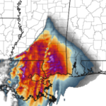
The SPC is considering extending the Tornado Watch for south Mississippi: SUMMARY…Threat for damaging winds and perhaps a couple of tornadoes will potentially focus over southeastern Louisiana and parts of southern Mississippi later tonight. A replacement watch may be considered prior to the 07Z expiration of Watches 111/113. DISCUSSION…An expansive mesoscale convective system continues late this evening across the lower… Read more →
Latest from the WPC: SUMMARY…FLASH FLOODING THREAT IS RATCHETING DOWN A NOTCH FROM EXTREME LEVELS AS FOCUS OF HVY RAIN SHIFTS SOUTHWARD. STILL HVY RAINFALL AND FLASH FLOODING REMAINS LIKELY THROUGH THE EARLY NIGHTTIME HOURS. DISCUSSION…LARGE SCALE PATTERN AND LINEAR MCS WITH TRAINING CONVECTION ACROSS CENTRAL LA INTO CENTRAL MS HAS BEGUN TO SHOW SIGNS OF WEAKENING AND COLD POOL… Read more →

As a deepening area of low pressure moves by from Texas to Tennessee, it will open the atmosphere aloft leading to showers and storms across eastern Texas, Louisiana, Mississippi and Alabama. This discussion is specifically for south Mississippi. From the SPC UPDATE 9:30 PM 4/2/17: The SPC has put south Mississippi back under an Enhanced Risk DISCUSSION…While northern portions of… Read more →
Mesoscale Discussion 0370 NWS Storm Prediction Center Norman OK 0550 PM CDT Wed Mar 29 2017 Areas affected…Portions of LA…western MS…southeast AR Concerning…Tornado Watch 98… Valid 292250Z – 300045Z The severe weather threat for Tornado Watch 98 continues. SUMMARY…The risk for severe thunderstorms and tornadoes continues across Tornado Watch 98, and will spread east-northeastward and northeastward through the evening and… Read more →