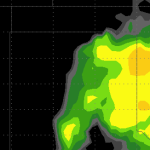
We’re still tracking the chance for severe weather later this afternoon, this evening and into the overnight hours…
Severe Weather Outlook Live Stream (3/8/13)
Looks like the 18z NAM computer weather model is showing some bias toward a more organized severe weather event for Friday.
As it looks right now, it has the dryline set up from Dalhart to Friona with storms starting to fire – like mentioned earlier – between 3pm and 5pm. Now it is suggesting CAPE values in the 400 to 1,000 range with bulk shear still looking like 40kts and higher. It also shows dewpoints in the 50s and temperatures in the 60s.
Very interesting…

NWS SPC analyzes Texas Panhandle thunderstorm threat
Earlier today the National Weather Service (NWS) Storm Prediction Center (SPC) gave their analysis of the severe weather situation for the Texas Panhandle. It reads: SHORT TERM FORECAST GUIDANCE CONTINUES TO INDICATE MODEST MOISTURE RETURN ON INCREASING S/SELY LOW LEVEL FLOW AHEAD OF A DRYLINE EXTENDING SWD FROM LEE CYCLONE OVER SE CO INTO SW TX. DEWPOINTS NEAR 50 F… Read more →

