10PM UPDATE: Hurricane Michael continues north, strengthens
BULLETIN Hurricane Michael Advisory Number 10 NWS National Hurricane Center Miami FL AL142018 1000 PM CDT Mon Oct 08 2018 …MICHAEL CONTINUES TO STRENGTHEN… …STORM SURGE AND HURRICANE WARNINGS IN EFFECT FOR THE NORTHEASTERN GULF COAST… SUMMARY OF 1000 PM CDT…0300 UTC…INFORMATION ———————————————– LOCATION…23.2N 85.3W ABOUT 485 MI…780 KM S OF PANAMA CITY FLORIDA ABOUT 450 MI…725 KM S OF… Read more →
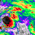
Down and Dirty details: Quick update on Invest91L development, possible threat to Gulf coast
*** 400PM UPDATE FROM NHC*** BULLETIN Potential Tropical Cyclone Fourteen Advisory Number 1 NWS National Hurricane Center Miami FL AL142018 400 PM CDT Sat Oct 06 2018 …DISTURBANCE GETTING BETTER ORGANIZED OVER THE NORTHWESTERN CARIBBEAN SEA… …WARNINGS AND WATCHES ISSUED FOR PORTIONS OF WESTERN CUBA AND THE YUCATAN PENINSULA.. SUMMARY OF 400 PM CDT…2100 UTC…INFORMATION ———————————————- LOCATION…18.0N 86.6W ABOUT 175… Read more →
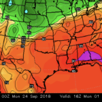
Hey Nick, where is that cold you were talkin’ ’bout?
Oh boy. There are a couple of things I will – purposefully – under-forecast in South Mississippi: 1. Snowfall totals 2. Wintertime overnight temperatures when there is any wind 3. First cool down in September In general, I won’t forecast these things more than 5 days out. And If I do, it’ll only happen when the confidence is pretty high…. Read more →

