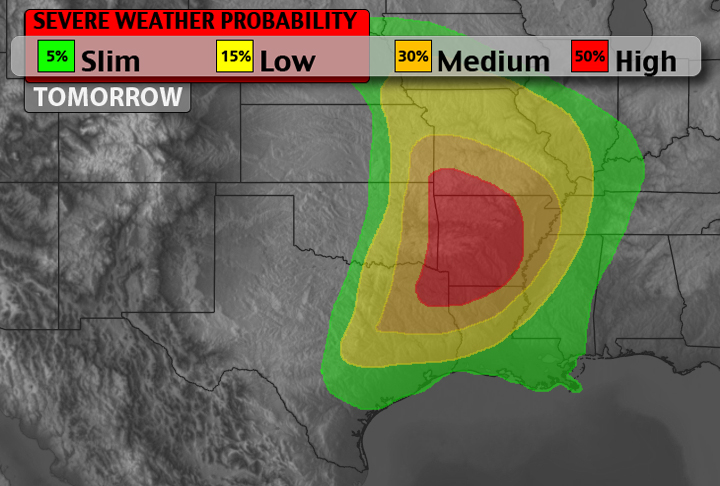
Tomorrow will be an active severe weather day across parts of the South Plains and Southeast.

Tomorrow will be an active severe weather day across parts of the South Plains and Southeast.

Good morning / afternoon everyone. After taking another look at the latest model runs I’ve crafted a different area for where severe weather will be likely today. Notice that the threat shifted a little farther east and has been expanded. Also the tornado threat has been expanded and shifted east. Right now, the threat for EF-2 or greater tornadoes isn’t… Read more →

In Texas, April is the start of a pretty active spring. According to the National Climate Data Center, Texas will see – on average – 28 tornadoes in April. Meanwhile, in the southeast, a “hotbed” for early-spring tornado activity in recent years, most states only average between five and eight tornadoes. Looking back at the past three months, there has… Read more →
The Storm Prediction Center has “upped” the threat for tornadoes across Kentucky, Ohio and a sliver of West Virginia this afternoon.

Twitter is a great place to find pictures of the damage from the flooding on Sunday night / Monday morning. Take a look. These dumpsters floated about 40 feet away from their original location #alwx @CBS42 pic.twitter.com/1Ohuwyx1Y0 — Melissa Y. Kim (@melissaykim) April 7, 2014 We have video from little shades creek on Laurel View Lane just off Rocky Ridge… Read more →