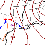
December 22-23 Gulf Coast severe weather threat
UPDATE 9:00 AM: The NWS SPC has updated the forecast graphics for today. They have removed the mention for severe hail and moved the “Marginal” risk farther south. The surface observations show most of the region with winds from the east or northeast. In other words, the warm front that will push north across Louisiana, Mississippi and Alabama is still off… Read more →
December 22-23 Severe Weather Threat for Southern Mississippi
It looks like Monday December 22nd and Tuesday December 23rd will be relatively active across the southeast. Scenario A large area of low pressure across the upper-Midwest will push a cold front through the the southeast. The change in airmass will promote the development of showers and thunderstorms for parts of Louisiana, Arkansas, Tennessee, Mississippi, Alabama and Georgia. The latest… Read more →

Not all weather records are created equal
Truth is, I knew this. But, at times, I get lulled into a false sense of National-Weather-Service-security. The NWS has created quite the reputation of being pretty dependable over the past 15 years. Sometimes it is hard to remember a time when people were taking measurements by analogue thermometer, writing it in a diary, and reporting it to the local… Read more →

Gulf Coast faces severe weather threat Nov 22-23
Saturday night and into Sunday morning Louisiana, Southern Mississippi and southern Alabama will be dealing with the opportunity for severe weather. Scenario An area of low pressure will swing through Texas and move across the lower Mississippi valley and into southern Tennessee and northern Alabama. As it moves through a warm front will allow moisture to surge northward out of… Read more →

