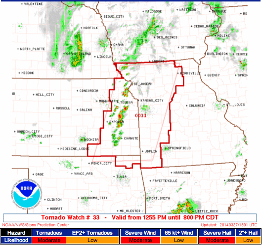
A Tornado Watch is in effect until 8:00pm for the following areas:

According to the Storm Prediction Center tornadoes, large hail and damaging winds are the main threats.
The SPC warned “multiple tornadoes possible” as this event unfolds.

Here is the latest watch boxe from the Storm Prediction Center: “Moderate” threat for EF-2 or greater tornadoes. Be alert and weather aware.
A Tornado Watch is in effect until 8:00pm for the following areas:

According to the Storm Prediction Center tornadoes, large hail and damaging winds are the main threats.
The SPC warned “multiple tornadoes possible” as this event unfolds.
Just for fun, I wanted to take a look at how we did for rainfall estimates across the southern plains yesterday…
The forecast looked like this:
Abilene – 50% || .50″ – .75″
Amarillo – 40% || .10″ – .25″
Dallas – 60% || 1.00″ – 1.25″
Lubbock – 50% || .25″ – .50″Guymon – 30% || .10″ – .25″
Lawton – 60% || 1.25″ – 1.50″
Oklahoma City – 70% || 2.00″ – 2.25″Dodge City – 30% || .10″ – .25″
Hays – 30% || .10″ – .25″
Wichita – 50% || .75″ – 1.25″
This morning, I looked into the rain totals for Friday, Saturday and Sunday morning. And here is how it looked:

Abilene – .61″
Amarillo – .00″
Dallas – 1.29″
Lubbock – .00″
Guymon – .00″
Lawton – .44″
Oklahoma City – .66″
Dodge City – .00″
Hays – .00″
Wichita – .20″
Taking a look at the NOAA 24hr precip estimates from radar data, it looks like the heaviest rain that was anticipated to roll through Lawton and eventually Oklahoma City shifted slightly south and a little east.
Dallas set a record.
Places like Wichita Falls, Texas (1.84″) through Ada, Oklahoma (2.33″) and into Fort Smith, Arkansas (1.71″) received the most rain.

So far, so good. It looks like the forecast is verifying for the southern plains. While most of the severe weather is staying in east Texas, a solid soaking rain with strong-to-severe storms are rolling across parts of Oklahoma and north and west Texas. Even south central Kansas is getting into the act.
It will be interesting to see the rain totals from this round of rain.
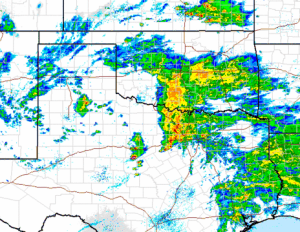
Here is a look at the 5:45pm radar