Buckle up Amarillo, a return of the 90s this week. Perhaps a few chances for rain, too.
I’ll get a full write-up published by this afternoon…
Buckle up Amarillo, a return of the 90s this week. Perhaps a few chances for rain, too.
I’ll get a full write-up published by this afternoon…

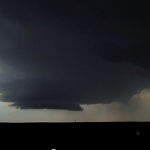
I had a chance to work my less-than-stellar photoshop skills on a few of the pics I shot while out storm chasing on Wednesday. This is a look at the biggest storm we could find – it was near Memphis, Texas. [slideshow id=4]
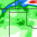
This afternoon is looking interesting, but not impressive, if you are a storm chaser. As an area of low pressure pushes into the four corners region it will help offer some lift our ahead of it. That means the chance for showers and storms in Texas, Oklahoma and Kansas.
The question will be how developed can these storms become. And how fast.

For places east of a line from Garden City, Kansas south to Turpin, Oklahoma and continuing to Paducah, Texas there is a chance for some afternoon showers and thunderstorms. Some of these storms could become severe.
The main threats for today are large hail and damaging winds. In fact hail stones in excess of two-inches (think egg-sized) could be seen across parts of western Oklahoma.
But that’s not all, we also have to worry about a tornado threat this afternoon. While the SPC has issued a 5-percent tornado risk, I feel like that might be edged back to just a 2-percent as we head toward the afternoon.
But even at 2-percent, I think a tornado will be seen somewhere today.

I know it feels like forever since the Texas and Oklahoma panhandles have received any rainfall. While it hasn’t been THAT long in the grand scheme of things it has been almost two full months since we received .10″ of rain or more. Seriously. Our last rainfall of .10″ or more was March, 8th. In fact, since the Blizzard of… Read more →