I don’t think I made is clear enough in the video: This forecast is for tomorrow and not today.
Severe Weather Breakdown – 4/12/14
Update (4/12/14 2:20): It looks like the threat for severe weather is shifting north as we move through the day.
Here is the latest look at the RAP for the composite reflectivity at 8pm.
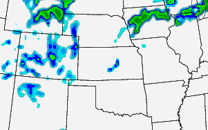
Notice most of the convection is north across parts of Iowa.
There is still the threat for severe weather despite the smaller coverage area. Also, there is still the threat for a renegade storm across parts of Kansas.
SPC MD 323
MD 0323 CONCERNING SEVERE POTENTIAL…WATCH UNLIKELY FOR PARTS OF SWRN MN…NE IA…SRN WI…NRN IL…SRN LAKE MI AND ADJACENT NW IND/SWRN MI MESOSCALE DISCUSSION 0323 NWS STORM PREDICTION CENTER NORMAN OK 1024 AM CDT SAT APR 12 2014 AREAS AFFECTED…PARTS OF SWRN MN…NE IA…SRN WI…NRN IL…SRN LAKE MI AND ADJACENT NW IND/SWRN MI CONCERNING…SEVERE POTENTIAL…WATCH UNLIKELY VALID 121524Z – 121730Z PROBABILITY… Read more →
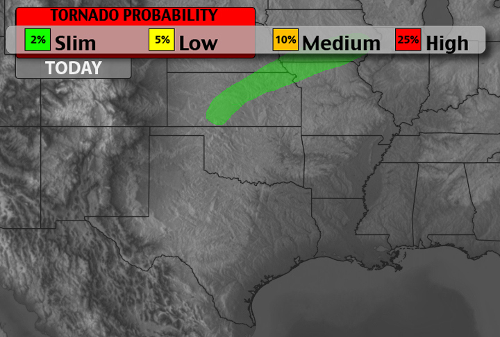
Today’s Severe Weather Potential – 4/12/14

M 6.1 – 92km SSW of Panguna, Papua New Guinea
PAGER – GREEN ShakeMap – VI DYFI? – I Time 2014-04-12 05:24:27 UTC 2014-04-12 15:24:27 +10:00 at epicenter Location 7.108°S 155.210°E Depth 56.50 km (35.11 mi) Powered by WPeMatico

