This is pretty cool. A guy dumped a camera in a bucket of water in West Texas to see who would show up for a drink…
Nick Lilja
Nick graduated from Oregon State University in 2008 with a Bachelor of Science in Earth Science with an emphasis in Atmospheric and Oceanic Sciences. He then earned a Master's from Syracuse University in 2011 in Broadcast & Digital Journalism.
All the while he has been on the air in multiple states. Now, though, he calls Mississippi home and is the Chief Meteorologist for WDAM, a local television station, and works part time as an Adjunct Professor at the University of Southern Mississippi teaching a course in meteorology.
One last round of severe weather for south Mississippi
Another area of low pressure will swing through the southeast opening the door for showers and storms to develop across Louisiana, Mississippi and Alabama. Storms will move from west to east across the Gulf Coast during the day on Wednesday and then into the overnight hours through Thursday morning. Quickly, now… no time to waste South Mississippi is under a… Read more →
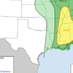
New Day 2 Severe Weather Outlook from SPC shows lower tornado risk
Latest from the SPC: With such an amplified system and strong meridional flow aloft, multiple areas of convection will likely be ongoing Sunday morning. The main influencing factor regarding timing and location of potential severe weather will be with one or more north-south oriented bands of storms across parts of the lower/mid Mississippi Valleys, likely in advance of the surface… Read more →
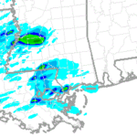
Severe weather Sunday for South Mississippi
Thunderstorms are likely Sunday during the day in South Mississippi. In fact, everyone east of I-55 and south of I-20 will have see a thunderstorm. That’s right, everyone in that box will see a storm. And while the chances that you see a thunderstorm are running between 90- and 100-percent. The chance that you see a severe storm are a… Read more →
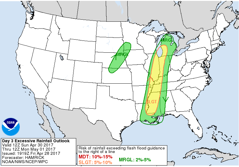
Severe weather, flooding back for Louisiana, Mississippi, Alabama
As a deep area of low pressure lifts from Texas into the upper Midwest, a cold front will push through Louisiana, Mississippi and Alabama opening the door for showers, storms and severe weather. Quick Summary Storms will push across the region in two waves. One during late Saturday and into Sunday morning. Another Sunday afternoon/evening and into Monday. Originally, flooding… Read more →

